Overview of the Map Application
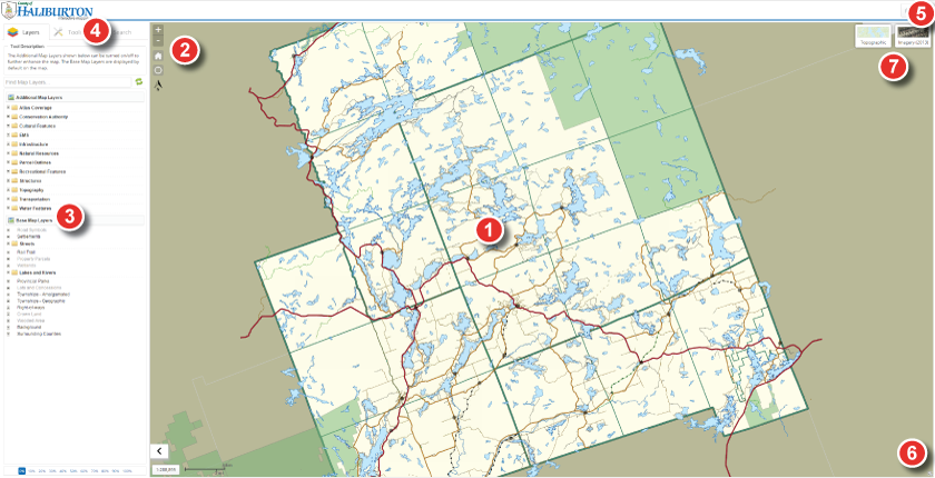
1. Map View
- Displays the map extent (map view)
- Original map extent (full extent) shown in image above
2. Map Navigation
- Used to Zoom in and out of the map extent
- Used to return to the original map extent
- Used to locate the users current GPS position on the map
3. Table of Contents (Map Layers)
- Used to turn specific layers on or off in the map
- Used to view layer symbology
- Used to set transparency for layers added to the map
- Can be toggled ON or OFF to maximimize the map view.
4. Tools and Searches
- Used to access various tools for identifying features, gathering
geographic coordinates, measuring, creating bookmarks and much more.
- Used to access search engines for locating an address, street name,
lot and concessions, property(s) and street intersections.
5. Menu and Information Links
- Used to access help and contact information quickly and easily,
as well as the terms of reference.
- Used to share the map with other users (Generate Link)
- Used to take a screen shot of the map (Generage Map Image)
- Used to minimize the table of contents
6. Map Overview
- Used as a birds eye view of the map
7. Topographic and Ortho View
- Used to switch between the topographic or Orthophotography
view in the map.
Note: Orthophotography is available on the Municipal WebGIS only.