Overview of the Map Application
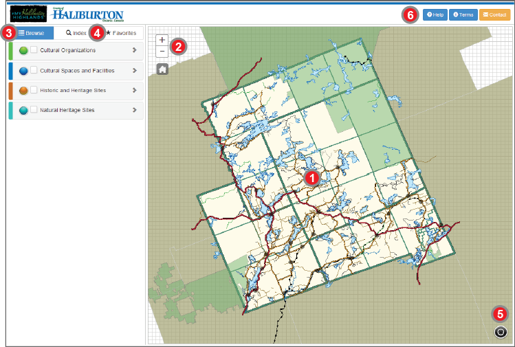
1. Map View
- Displays the map extent (map view)
- Original map extent (full extent) shown in image above
2. Map Navigation
- Used to Zoom in and out of the map extent
- Used to return to the original map extent
3. Table of Contents (Map Layers)
- Used to turn on and off specific features in the map
- Used to view feature symbols in the map
4. Search Tools
- Used to access feature information quickly and easily
5. My Location
- Used to locate your geographic position in the County of Haliburton.
6. Information Links
- used to access help and contact information quickly and easily, as well as the terms of reference.